GGE6022 hydrography knowledge

Inverse Barometric Effect: A Contribution to Dynamic Ocean Topography

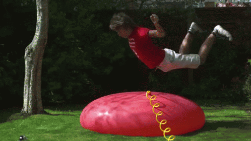
One of the topics I omitted in the first post of this series was the inverse barometric (IB) effect. Think of someone jumping on the side of a waterbed, their mass adds pressure to the water which in turn causes it to flow to places where there is less pressure, like the other side of the bed. In the natural world high pressure weather systems can push the ocean down much like the person jumping on the water bed. With a low pressure system such as a rainstorm the opposite happens, more water can move into the area, like the side of the water bed without a person on it.

One of the most noticeable effects of IB is a storm surge. During a storm, because of the low pressure more water can flow into the area from areas where the air pressure is higher on the ocean. This in turn can cause flooding in areas that would not normally get water with normal tide cycles.

The IB effect clearly relates to non-tidal changes in water height, which we described as dynamic ocean topography (DOT) in the first post. I’d like to take you back through the history of the scientific understanding of IB and its connection to DOT to give some context to our current understanding, but also because I think it’s a really interesting story. This ties into an important discovery in geodesy that lead to our current understanding, or model of how the earth is shaped and how it spins, and even our current theory of how continents move, also known as plate tectonics.

In the late 1800’s the prevailing understanding of the earth was that it was a hard ball (a little wider at the equator, just like me) and that it had a fixed axis of rotation. A desk globe on a rod is a good example of this, the globe is rigid and the rod, the axis of rotation, doesn’t move in its relationship with the globe other than to let the globe spin around it. This model made a lot of sense because it mostly agreed with astronomical observations. Even before the 1800s astronomers could measure the location of an object in the sky (like a star) and very accurately determine their latitude, or how far from the equator they were. By the 1800s the observatories were becoming extremely precise, and if measured over a long enough period they could achieve a precision of better than 0.1 seconds of latitude, which is about 3 meters (or ~10 feet). As the measurements became more precise a new problem emerged. Many of these observations done over months, or even years, started to show a wobble. Even though they were very precise they didn’t seem as accurate and some scientist believed the wobble was simply errors in their measurements.

A scientist by the name of Chandler became extremely interested in these changes in latitude. He spent nearly 15 years making his own observations, and recomputing by hand many years of others’ observations. In 1891 he published his findings in a series of papers and described what ultimately came to be known as the Chandler wobble. Chandler was able to describe most of the changes in latitude that astronomers were observing with a model of the earth that suggested the axis of rotation moved away from its pole. At it’s largest Chandler suggested the axis moved as much as 9 meters (~30 feet) generally migrating around the poles. Going back to the desk globe you can think of this as the globe having holes that are just a little too big where the rod goes through the globe. The rod still won’t move, but the globe will wobble around a little when it’s spun.

This discovery lead to a very intriguing conclusion. The best mathematical model that could explain the Chandler wobble was one where the earth was just a little bit squishy.

With a new understanding of the behavior of the earth this opened up new questions. While the squishy earth and the Chandler wobble of the earth’s axis explained most of the variation in latitude there were still smaller variations that remained unexplained. In 1916 Jeffreys published a paper that tried to explain these left over changes through the movements of mass on the face of the earth. He described movement of the atmosphere as seen in weather, changes in the height of the ocean, and even plants moving mass higher in the springtime when new leaves grew and sap moves from roots up into the branches. Jeffries made a relatively simple math model, where he thought about a small particle and the effect it would have on the earth’s rotation if it moved farther from or closer to the earth’s surface. From that math model came the original equation for the inverse barometric effect, which on a global scale when applied to observations helped to explain part of that left over change in latitude.

The equation that Jeffries derived was simply that the change in water height is the opposite of the change in atmospheric pressure divided by the force density of water (which is a measure of how hard you have to push on water to move it up or down). The difficulty with this is that if you move water it has to go somewhere, in physics this is called the law of conservation of mass. Think of a water balloon, if you poke it on one side you’ll see the whole thing vibrate. On a global scale an atmospheric high pressure system is much like poking the oceans. It will cause slow waves (much slower than waves you see at the beach) to move through the oceans, but there are many of these pokes all over the oceans, and the continents get in the way deflecting these waves… What seemed simple is much more complicated in reality.

Over the years many people made more sophisticated models to try and describe these complex interactions. Carl Wunsch and Detlef Stammer (1997) summarized these efforts and the best math models available. Validation was difficult and generally relied on tide gauges and barometric pressure gauges located on islands in the middle of the world’s oceans. Sometimes Jeffreys’ math did a really good job of describing non-tidal changes in water height, and sometimes it just didn’t. As we started to get satellites up that could very precisely measure ocean heights some of the confusion was cleared up. Wunsch and Stammer (1997) showed that applying the IB equation to global sea heights from TOPEX/POSEIDON altimetric data showed that in high latitudes IB explained some of the changes in height, but especially at low latitudes, near the equator, IB did not explain the variations in height.

Further research into IB is ongoing. It is impressive how well scientists were able to describe global phenomena in the 1800s and early 1900 that only recently we’ve been able validate on large global scales.

References


Other Posts in the Series